Satellite tech delivers breakthrough in water monitoring
James Cook University and Southern Gulf NRM have been using satellite-based water monitoring tools to help producers plan for drought, improve water access reliability and boost livestock productivity.
The $79,000 project was supported by the Australian Government’s Future Drought Fund through the TNQ Drought Hub.
It was led by JCU’s Ben Jarihani, Senior Lecturer in Environmental Earth Science. He said water is the lifeblood of grazing systems in Northern Australia.
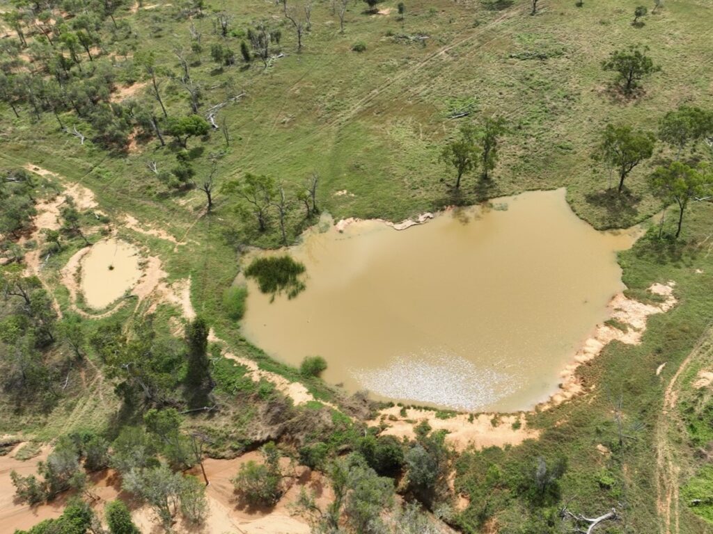
“During dry spells, the availability and location of water directly affect livestock welfare, pasture condition, productivity and biodiversity. Small water bodies, such as farm dams, creeks and natural waterholes play a disproportionately large role in supporting these systems,” said Dr Jarihani.
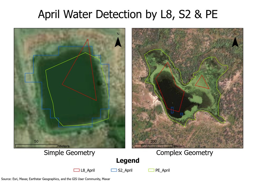
He said these small systems are often overlooked in traditional monitoring due to their size and seasonal variability.
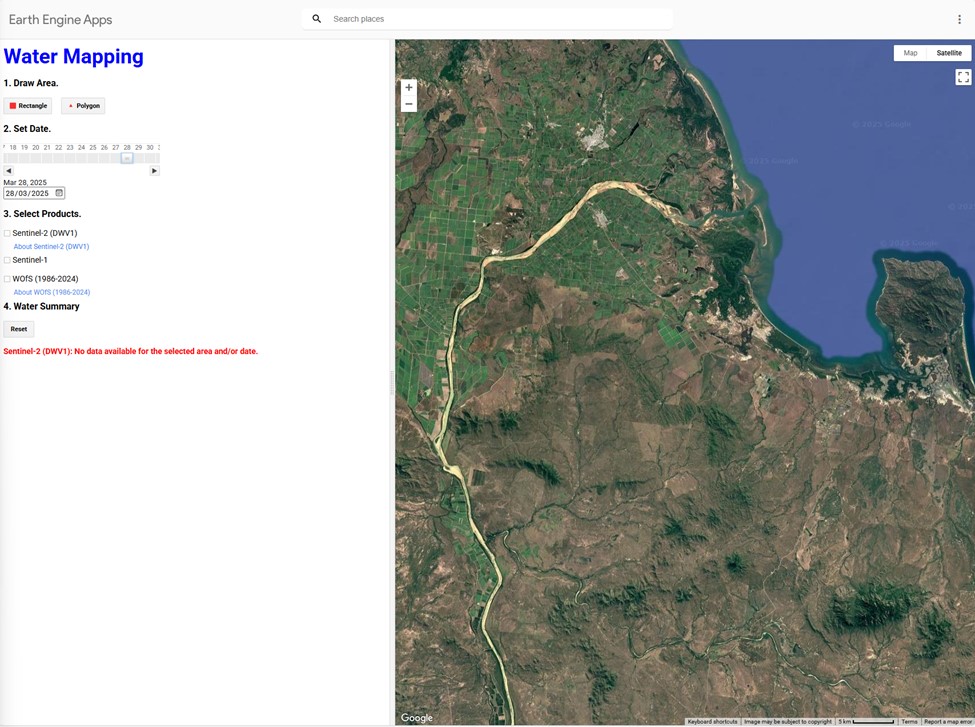
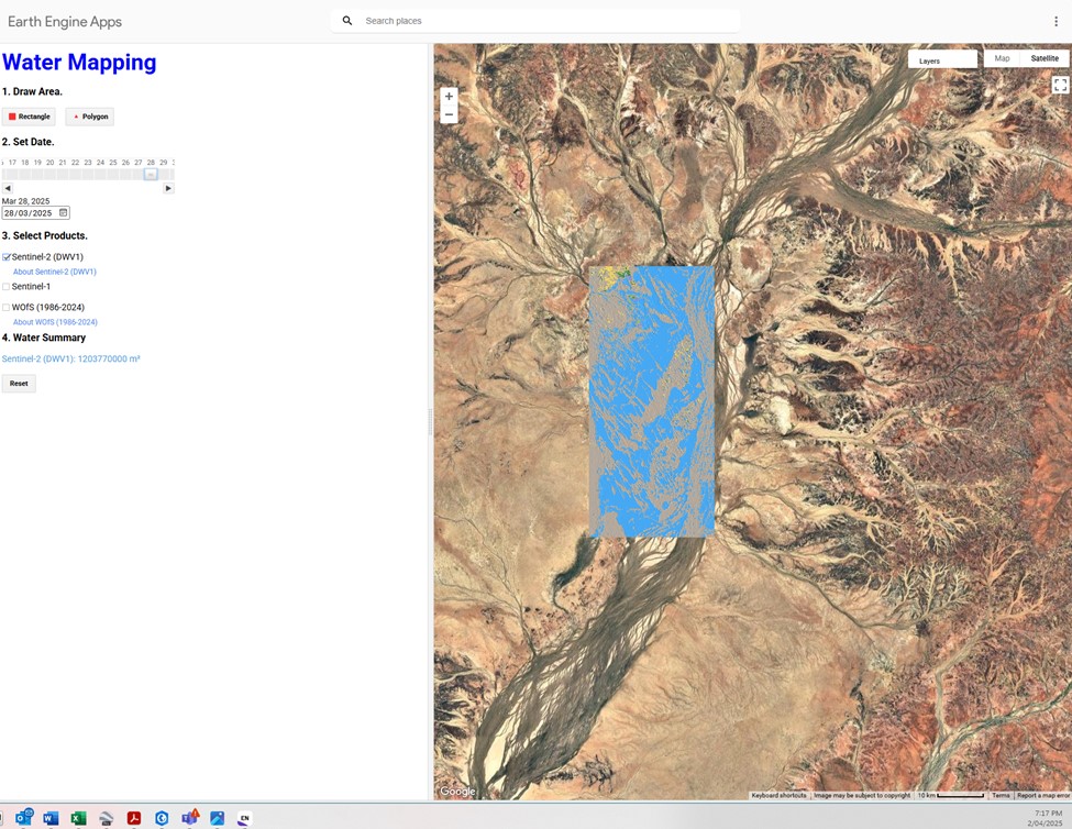
“We used satellite imagery, drone surveys and on-ground checks to produce a prototype user-friendly mapping app that allows near real-time visualisation of water availability,” said Dr Jarihani.
Mapping water bodies in Southern Gulf region
“Farmers can now track changes in small water bodies, plan stock movements, and design water infrastructure with unprecedented accuracy.”
He said the approach is scalable across northern Australia, offering a cost-effective way to strengthen drought preparedness, reduce calf losses and protect rangeland health.
“Water is the lifeblood of grazing systems. By combining cutting-edge science with local knowledge, we’ve created tools that give producers the confidence to plan for both dry spells and floods,” said Dr Jarihani.

