Assessing Mitchell Grasslands with the Aid of Drones and Artificial Intelligence
Background
The rangelands are dominated by grazing (cattle, sheep and goats), as well as indigenous enterprises and mining which support a population of some 600,000 people. The sustainable livestock carrying capacity required to maintain resource condition is strongly dependent on rainfall and temperature. Australia’s rangelands have the most variable rainfall in the world. The use of management strategies and technology will assist rangelands producers to improve grazing management, pasture regeneration and water use efficiency and thus become more resilient to drought.
Utilising digital precision mapping technologies at the property scale, demonstration sites will be analysed using property utilisation and land condition tools to develop a plan for future management and infrastructure changes that could be implemented to improve drought resilience.
“Understanding where your land condition is, how well your country can respond to rain to maintain your pastoral enterprise, is fundamental towards actually being able to manage to improve land condition, and also being able to manage in terms of responding to future drought and climate events.”
David Phelps
Director, TNQ Drought Hub
The Project
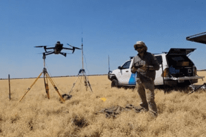
High resolution photos captured from drones can provide a wealth of information about the health and condition of a paddock, such as the amount and distribution of pasture and weeds, as well as the location of roads, cattle pads, fences and watering points.
Southern Gulf NRM, James Cook University and MaxusAI, supported by the TNQ Drought Hub, have been trialing the potential of this new technology on the identification and classification of Mitchell grass tussocks in the Southern Gulf rangelands areas.
The Results
The project has demonstrated that high resolution drone imagery, coupled with a relatively simple AI processing workflow, can be used to reliably detect Mitchell grass tussocks at the end of the dry season. Further, tussock densities can be related to land condition score using pre-defined criteria.
The approach developed and tested in this project could be readily applied/adapted by a range of stakeholders (such as Natural Resource Management groups, Government extension officers, researchers, and individual landholders), to assist in the assessment of pasture and land condition in different contexts.
Information on tussock density and land condition can, for example, be used to better match stocking rates to available forage to prevent pasture run down and associated land degradation issues, such as erosion and weed incursion. The approach could also be used to quantitatively evaluate the response in land condition to a change in land management practice, remediation activities, and/or climate.
To assist practitioners in the implementation of this approach, a preliminary standard operating procedure is presented in the report, in addition to an overview of practical considerations for practitioners.
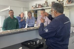
TNQ producers gain deeper understanding of rangelands and cropping management...Read More
This collaborative project is a part of the Australian Government’s Future Drought Fund ‘Managing Rangelands for Drought Resilience project’ which brings together six Drought Hubs to showcase technologies and techniques that use mapping to improve rangeland management across Australia.